


EDWARDSVILLE WD 02, Luzerne County, Pennsylvania
About
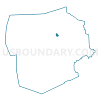
Outline

Summary
| Unique Area Identifier | 660872 |
| Name | EDWARDSVILLE WD 02 |
| County | Luzerne County |
| State | Pennsylvania |
| Area (square miles) | 0.78 |
| Land Area (square miles) | 0.75 |
| Water Area (square miles) | 0.04 |
| % of Land Area | 95.51 |
| % of Water Area | 4.49 |
| Latitude of the Internal Point | 41.25823570 |
| Longtitude of the Internal Point | -75.90554520 |
Maps


Graphs
Select a template below for downloading or customizing gragh for EDWARDSVILLE WD 02, Luzerne County, Pennsylvania


Neighbors
Neighoring Voting District (by Name) Neighboring Voting District on the Map
- EDWARDSVILLE WD 01, Luzerne County, PA
- EDWARDSVILLE WD 03, Luzerne County, PA
- KINGSTON WD 01, Luzerne County, PA
- KINGSTON WD 06, Luzerne County, PA
- KINGSTON WD 08, Luzerne County, PA
- LARKSVILLE WD 01, Luzerne County, PA
- LARKSVILLE WD 03, Luzerne County, PA
- LARKSVILLE WD 04, Luzerne County, PA
- WILKES-BARRE TWP WD 13, Luzerne County, PA
- WILKES-BARRE TWP WD 15, Luzerne County, PA
Top 10 Neighboring County Subdivision (by Population) Neighboring County Subdivision on the Map
- Wilkes-Barre city, Luzerne County, PA (41,498)
- Kingston borough, Luzerne County, PA (13,182)
- Edwardsville borough, Luzerne County, PA (4,816)
- Larksville borough, Luzerne County, PA (4,480)
Top 10 Neighboring Place (by Population) Neighboring Place on the Map
- Wilkes-Barre city, PA (41,498)
- Kingston borough, PA (13,182)
- Edwardsville borough, PA (4,816)
- Larksville borough, PA (4,480)
Top 10 Neighboring Unified School District (by Population) Neighboring Unified School District on the Map
Top 10 Neighboring State Legislative District Lower Chamber (by Population) Neighboring State Legislative District Lower Chamber on the Map
- State House District 119, PA (58,443)
- State House District 121, PA (57,813)
- State House District 120, PA (57,355)
Top 10 Neighboring State Legislative District Upper Chamber (by Population) Neighboring State Legislative District Upper Chamber on the Map
Top 10 Neighboring 111th Congressional District (by Population) Neighboring 111th Congressional District on the Map
Top 10 Neighboring Census Tract (by Population) Neighboring Census Tract on the Map
- Census Tract 2127, Luzerne County, PA (5,158)
- Census Tract 2132, Luzerne County, PA (4,816)
- Census Tract 2134, Luzerne County, PA (4,480)
- Census Tract 2002, Luzerne County, PA (3,630)
- Census Tract 2001, Luzerne County, PA (2,867)
- Census Tract 2131, Luzerne County, PA (1,710)
- Census Tract 2130, Luzerne County, PA (1,405)